Mountains of Colombia
Colombia had never been in my plans, but the beauty of life lies precisely in its surprises. Destiny and two friends brought me to this beautiful country, which I didn’t hesitate to explore to the fullest.
After a week enjoying Medellin and Santa Marta with my girls, I launched into a 20-day solo adventure through Colombia. My exploration—and this blog—focus primarily on the ascent of the Nevado del Tolima Volcano, in the heart of the Central Andes.
My “warm-up” consisted of Cerro Tusa, Cerro Kennedy, and El Púlpito del Diablo.
Warm-up in the Mountains
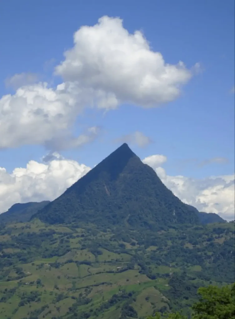
Cerro Tusa: The Natural Pyramid
Cerro Tusa is as mystical as it gets. I climbed it on a day trip, not so much for its altitude—it barely reaches 2,000 m—but for its significant elevation gain over just a few kilometers and its mysterious, perfect pyramid shape that attracts so many local stories and legends.
Cerro Kennedy and the Sierra Nevada de Santa Marta
Equally mysterious was my subsequent solo ascent of Cerro Kennedy while exploring Minca and the surroundings of the Sierra Nevada de Santa Marta in the north.
Minca and Santa Marta sit at the foothills of this National Park, which contains Colombia’s two highest twin peaks: Pico Cristóbal Colón and Pico Simón Bolívar (5,775 m). Imposing and snow-capped, I could see them from the summit of Cerro Kennedy (2,900 m), which housed a military mountain base responsible for monitoring local guerrilla activity. I chatted with the soldiers and ate my sandwich on the roof of one of their military buildings while we talked about life.
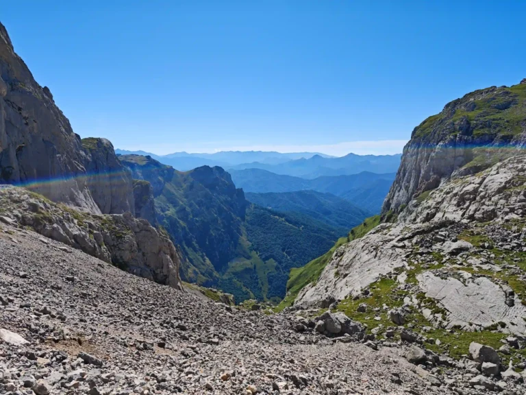
El Púlpito del Diablo: High Altitude in the Sierra Nevada del Cocuy
From there, I traveled southeast to the world’s largest tropical glacial complex, located in the Eastern Range of the Colombian Andes: the Sierra Nevada del Cocuy.
I made my debut at 4,000 meters during the ascent to Púlpito del Diablo (4,800 m) on a day when bad weather accompanied us throughout the climb. At the summit, while I was insisting on heading back down because my hands were freezing, the clouds suddenly parted to reveal the landscape: the square rock that gives the route its name and the rest of the snow-capped range. Simply spectacular.
 Tusa Hill
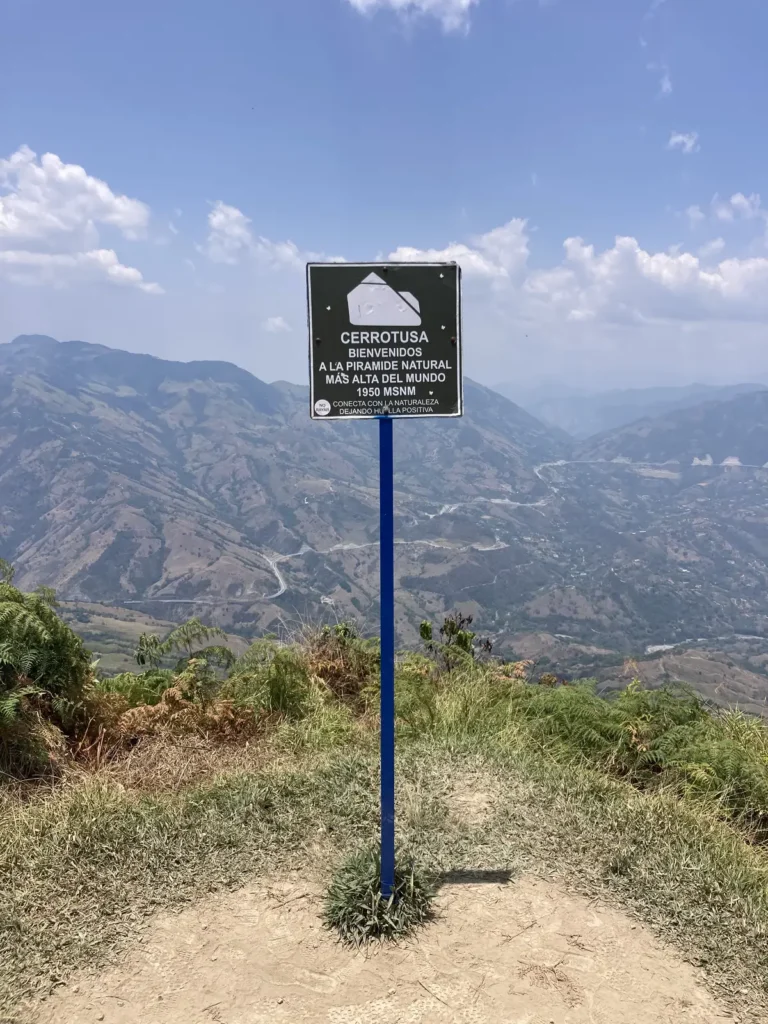 Signal in Tusa Hill
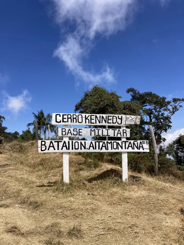 Kennedy Hill
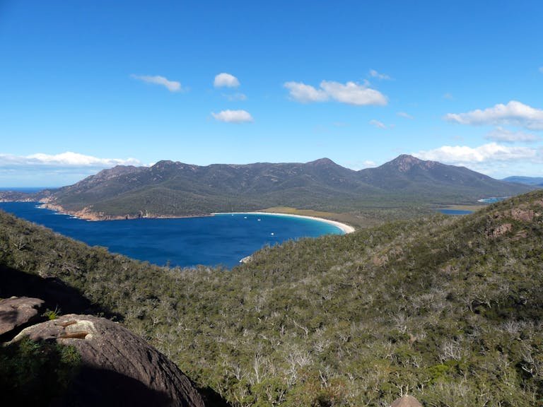
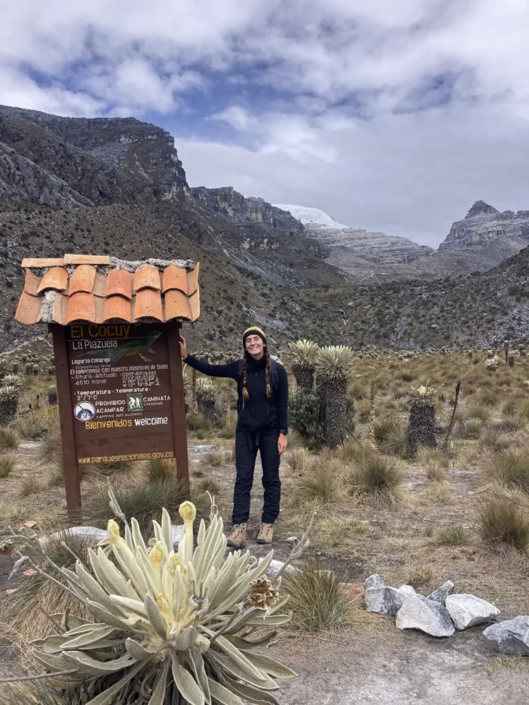 Cocuy
Cocuy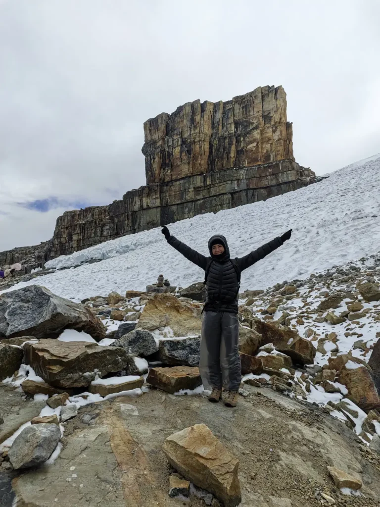 Púlpito del Diablo
The Trek to Nevado del Tolima: Starting the Expedition
A few days later, the Coffee Axis (Eje Cafetero) welcomed me with open arms. Salento served as my base before the big adventure, where I recharged my strength by eating well, drinking local coffee, and visiting plantations.
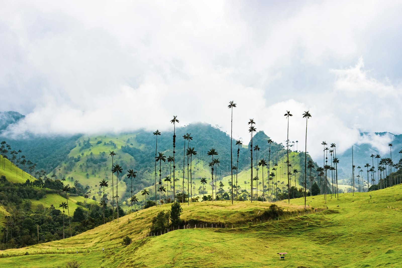
On April 11, 2024, at 07:00 AM, Sebastián (our local guide), Brendon, and I set off from Cocora Valley (2,000 m). There, the wax palms—reaching up to 60 meters high—bid us farewell with an indescribable sense of peace.
That same day, we left behind the heat and the Andean forest to enter the Páramo ecosystem. We finally encountered the famous frailejones (espeletia plants) and caught our first glimpse in the distance of the majestic Dulima—the local name for Nevado del Tolima.
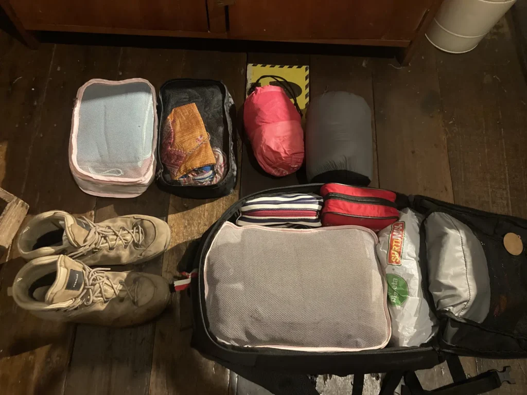
After a 20 km trek, Patricia and her family welcomed us at Finca La Playa (Camp 1, at 3,800 m), where we had dinner, rested, and drank plenty of warm agua panela.
The following day, we continued the ascent to the foothills of Tolima. It was a much shorter journey than the previous day, focused on acclimatization for the final push. We set up our tents at Camp 2 (4,300 m) and spent the afternoon practicing with the glacier gear we would be using.
The sunset we witnessed that day—with the Tolima volcano behind us, the frailejones all around, and pink clouds overhead—is something I will never forget. And oh, the silence.
 Cocoa processing in the Coffee Region
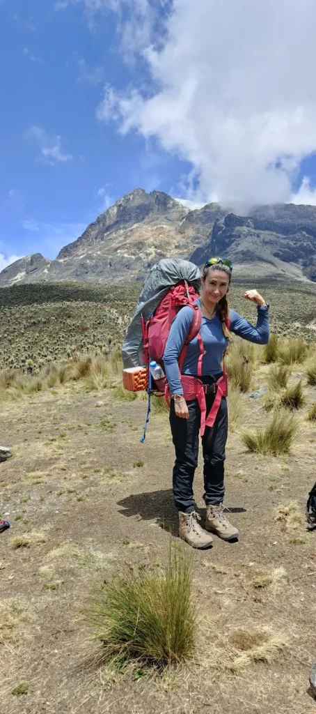 Ready for Tolima
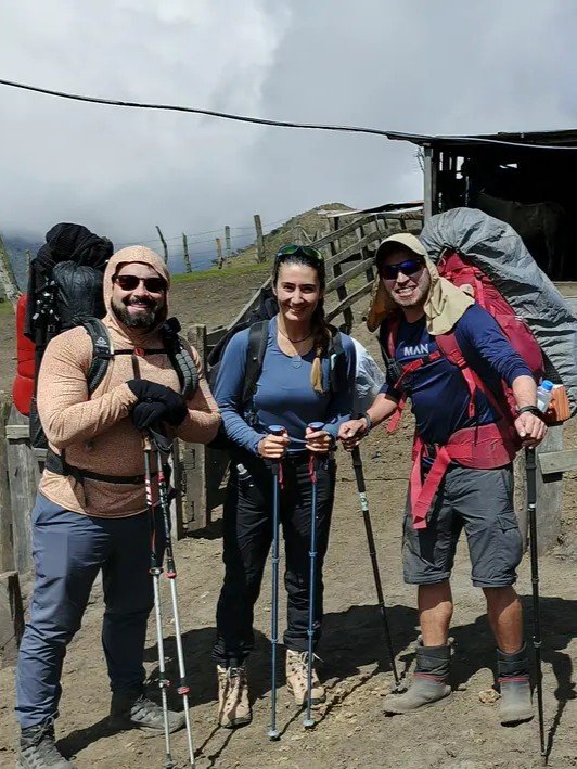 Camp 1 Tolima
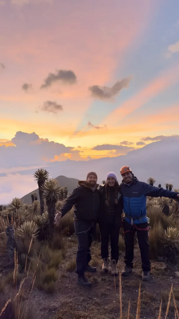 Sunset in Tolima
Final Ascent to Nevado del Tolima: My First 5,000m Peak
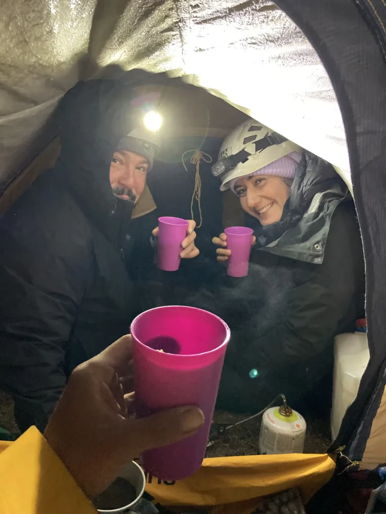
We went to bed at 8:00 PM with the alarm set for 1:00 AM. I didn’t sleep a wink—I was freezing, shivering uncontrollably, and my head was throbbing. I never knew if I was actually sick, just nervous, or suffering from altitude sickness, but at 1:00 AM I got up, ate some arepas, drank agua panela with brandy… and I felt better.
La noche parecía en paz, y al poco rato de empezar, el terreno cambió de golpe.
The night seemed peaceful, but shortly after starting, the terrain changed abruptly. We left the Andean páramo behind and began progressing roped together into what was now high-mountain territory and, soon, the glacier.
Colombia’s glaciers are disappearing and shrinking significantly every year. We reached the ice at about 5,000 meters, just as the first light of day appeared. We had 200 meters of ascent left to the summit, which felt endless to me. Every step was a struggle, and the exhaustion was overwhelming. Considering I had barely slept, by the time I reached the summit of Tolima, I had basically been awake for 24 hours.
The views were spectacular, and our goal felt closer with every breath. There were massive crevasses in the glacier, the Nevado del Ruiz volcano puffing smoke right in front of us, and a crystal-clear sky. Everything looked like something out of a fairy tale!
Three strangers reached the summit together and became great friends and rope team partners. We visited the massive, steaming crater, and I felt chills that even made me lose my appetite (well, that’s actually a lie—nothing makes me lose my appetite, hehehe).
 Before reaching the summit
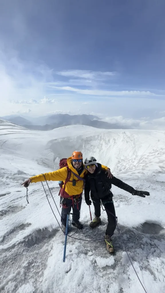 Summit of Nevado del Tolima
The Descent: The Other Side of the Challenge
The ascent was exhausting, but the descent… let’s not even talk about it. We didn’t stop at Camp 2 that day; we pushed all the way back to Camp 1. First, we returned to Camp 2 to eat and rest, then we struck the tents and continued down to Finca La Playa.
It was a grueling and incredibly long day. We arrived around 5:00 PM after spotting two condors along the way. I had dinner and fell asleep by 6:00 PM, and I didn’t know a thing about the world until they woke me up the next day at 8:00 AM with this sentence:
“You’ve officially broken the record for the most hours of sleep in this farmhouse!”
Returning to Cocora Valley and the Final Celebration
La ruta final hasta el Valle del Cocora nos la tomamos con calma.
We took the final trek back to the Cocora Valley at a slow pace. It was long with a lot of negative elevation gain, and the fatigue was heavy, but we had a blast celebrating the success of the expedition and fantasizing about the dinner and the party we were going to have in Salento upon our return.
And that’s exactly what happened.
Thanks, guys. What an incredible journey!
Si quieres conocer más sobre esta zona espectacular de los Andes colombianos, puedes visitar la web oficial del parque: Parque Nacional Natural Los Nevados — Información oficial sobre rutas, acceso, normativas y conservación del Nevado del Tolima.